Navigation
Navigation is the process of determining and controlling the position and direction of a vehicle or vessel. It can be done using various methods and tools, including celestial navigation, GPS (Global Positioning System), and maps.
Celestial Navigation
Celestial navigation is the use of celestial bodies such as the sun, moon, and stars to determine the position and direction of a vehicle. It involves measuring the angle between the celestial body and the horizon to calculate the position of the vehicle. This method has been used for centuries by sailors and navigators.
GPS (Global Positioning System)
GPS is a satellite-based navigation system that provides location and time information anywhere on or near the Earth. It works by using a network of satellites to determine the receiver's position through trilateration. GPS is commonly used in modern navigation systems for cars, ships, and aircraft.
Maps
Maps are visual representations of the Earth's surface or a region, showing geographical features, roads, and landmarks. They are essential tools for navigation, providing information about the relative positions of different locations and the best routes to take.
Study Guide
1. Celestial Navigation
- Understand the concept of celestial bodies as reference points for navigation.
- Learn how to use a sextant to measure the angle between a celestial body and the horizon.
- Practice calculating the position of a vehicle using celestial navigation techniques.
2. GPS (Global Positioning System)
- Study the working principle of GPS and how it determines the position of a receiver.
- Learn about the different types of GPS devices and their applications in navigation.
- Understand the factors that can affect the accuracy of GPS readings.
3. Maps
- Gain familiarity with different types of maps, including topographic maps, road maps, and nautical charts.
- Learn how to read and interpret maps, including understanding scales, symbols, and legends.
- Practice using maps to plan routes and navigate from one location to another.
By mastering these navigation techniques, you will develop a comprehensive understanding of how to determine and control the position and direction of a vehicle or vessel in various scenarios.
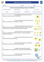
.◂Chemistry Worksheets and Study Guides High School. Atoms and Chemical Bonding
 Worksheet/Answer key
 Worksheet/Answer key
 Vocabulary/Answer key
 Vocabulary/Answer key