Geological Maps
Geological maps are tools used by geologists to represent the distribution of rock types, geological structures, and other features on the Earth's surface. These maps are essential for understanding the geology of a region, identifying potential mineral resources, and assessing geological hazards.
Key Components of Geological Maps
- Rock Units: Different rock types are represented by different colors or patterns on the map. These units are labeled with symbols and names.
- Geological Structures: Features such as faults, folds, and joints are depicted to show the geological history and tectonic processes in the area.
- Topographic Information: Elevation contours, rivers, and other topographic features provide context for the geological data.
- Legend: A key that explains the symbols and colors used on the map.
- Scale: Indicates the relationship between distances on the map and actual distances on the Earth's surface.
Interpreting Geological Maps
Understanding geological maps involves interpreting the spatial relationships between rock units, structures, and topographic features. Here are some key steps to interpreting a geological map:
- Identify Rock Units: Look for patterns and boundaries between different rock types. Pay attention to the age and composition of the rocks.
- Recognize Geological Structures: Note the orientation of folds, faults, and other structural features. These can provide insights into the region's tectonic history.
- Consider Topography: Understand how topographic features influence the distribution of rock units and structures. For example, mountain ranges may be associated with specific geological formations.
- Use the Legend and Scale: Refer to the legend to understand the map symbols and colors. Use the scale to gauge distances and the extent of the mapped area.
Uses of Geological Maps
Geological maps have various practical applications, including:
- Identifying potential mineral and energy resources
- Assessing geological hazards such as landslides and earthquakes
- Planning for construction projects and infrastructure development
- Understanding the environmental impact of human activities
Study Tips
To effectively study geological maps, consider the following tips:
- Practice identifying rock units and geological structures on maps of different regions.
- Review the regional geology and tectonic history of areas with well-documented geological maps.
- Compare geological maps with satellite imagery and aerial photographs to visualize the landscape and geological features.
- Work on map interpretation exercises to improve your skills in understanding the spatial relationships between geological features.
- Seek guidance from a geology instructor or tutor to clarify any challenging concepts related to geological mapping.
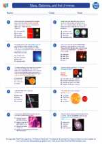
◂Earth Science Worksheets and Study Guides High School. Stars, Galaxies, and the Universe
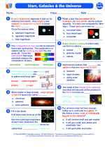
Worksheet/Answer key Stars, Galaxies, and the Universe
  Worksheet/Answer key
 Stars, Galaxies, and the Universe
  Worksheet/Answer key
 Stars, Galaxies, and the Universe
  Worksheet/Answer key
 Stars, Galaxies, and the Universe

 Worksheet/Answer key
 Worksheet/Answer key
 Worksheet/Answer key

The resources above cover the following skills:
EARTH AND SPACE SCIENCE (NGSS)
Earth’s Place in the Universe
Students who demonstrate understanding can:
Construct an explanation of the Big Bang theory based on astronomical evidence of light spectra, motion of distant galaxies, and composition of matter in the universe.
EARTH AND SPACE SCIENCE (NGSS)
Earth’s Place in the Universe
Students who demonstrate understanding can:
Construct an explanation of the Big Bang theory based on astronomical evidence of light spectra, motion of distant galaxies, and composition of matter in the universe.
EARTH AND SPACE SCIENCE (NGSS)
Earth’s Place in the Universe
Students who demonstrate understanding can:
Construct an explanation of the Big Bang theory based on astronomical evidence of light spectra, motion of distant galaxies, and composition of matter in the universe.
EARTH AND SPACE SCIENCE (NGSS)
Earth’s Place in the Universe
Students who demonstrate understanding can:
Construct an explanation of the Big Bang theory based on astronomical evidence of light spectra, motion of distant galaxies, and composition of matter in the universe.