Stratigraphy
Stratigraphy is the study of rock layers (strata) and the layering of rocks and sediments. It is a branch of geology that focuses on understanding the geological history of an area by analyzing the sequence, nature, and distribution of rock layers.
Key Concepts
- Principle of Superposition: In a sequence of undisturbed sedimentary rocks, the oldest rocks are at the bottom and the youngest are at the top.
- Stratigraphic Units: These are rock layers that are defined and identified based on their lithology, fossil content, and other physical characteristics.
- Geological Time Scale: Stratigraphy plays a crucial role in constructing and understanding the geological time scale, which divides Earth's history into eons, eras, periods, and epochs.
- Fossil Succession: Fossils found in rock layers can be used to correlate and date the layers, as well as to infer past environments and ecosystems.
- Unconformities: These are gaps in the rock record, often caused by erosion or non-deposition, and provide important clues about the geological history of an area.
Methods and Techniques
Stratigraphers use a variety of methods and techniques to study rock layers, including:
- Field Observations: Examining outcrops and rock formations in the field to understand the relationships between different layers.
- Mapping: Creating detailed maps of rock units and their distribution in a given area.
- Paleontology: Studying the fossil content of rocks to establish correlations and determine the relative ages of different layers.
- Geochronology: Using radiometric dating and other methods to determine the absolute ages of rock layers.
- Seismic Stratigraphy: Applying seismic reflection data to study the layers beneath the Earth's surface, particularly in marine environments.
Applications
Understanding stratigraphy has important practical applications in various fields, including:
- Petroleum Exploration: Identifying and characterizing rock layers that may contain oil and gas reservoirs.
- Environmental Geology: Assessing the potential for groundwater contamination, landslides, and other geological hazards.
- Archaeology: Using stratigraphic principles to interpret the layers of cultural deposits at archaeological sites.
- Climate and Earth History: Reconstructing past climate changes and understanding the evolution of landscapes and ecosystems.
Study Tips
To master the concepts of stratigraphy, consider the following study tips:
- Review the principles of superposition, original horizontality, and lateral continuity to understand how rock layers are formed and preserved.
- Practice interpreting and correlating rock layers in diagrams and cross-sections to develop your observational and analytical skills.
- Learn about key stratigraphic formations and their significance in different geological time periods.
- Explore case studies and real-world examples of how stratigraphy is used in geological and environmental investigations.
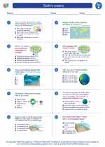
◂Science Worksheets and Study Guides Fifth Grade. Earth's oceans
Study Guide Earth's oceans
  Worksheet/Answer key
 Earth's oceans
  Worksheet/Answer key
 Earth's oceans
  Worksheet/Answer key
 Earth's oceans
  Vocabulary/Answer key
 Earth's oceans
  Vocabulary/Answer key
 Earth's oceans

 Worksheet/Answer key
 Worksheet/Answer key
 Worksheet/Answer key
 Vocabulary/Answer key
 Vocabulary/Answer key

The resources above cover the following skills:
EARTH AND SPACE SCIENCE
Earth’s Systems
Identify the distribution of freshwater and salt water on Earth (e.g., oceans, lakes, rivers, glaciers, ground water, polar ice caps) and construct a graphical representation depicting the amounts and percentages found in different reservoirs.