Stratus Clouds: Explanation and Study Guide
Stratus clouds are low-lying, horizontally layered clouds that form a uniform, grayish, and featureless layer. They are often seen on overcast days and can bring light drizzle or mist. Here's a study guide to help you understand stratus clouds better:
Formation of Stratus Clouds
Stratus clouds form when a large, stable air mass is lifted slowly and steadily. As the air rises, it cools and reaches its dew point, causing the water vapor to condense into a layer of stratus clouds.
Appearance of Stratus Clouds
Stratus clouds typically have a smooth and even appearance. They often cover the entire sky and can be identified by their featureless, grayish-white appearance. They are commonly found at low altitudes, below 6,500 feet (2,000 meters).
Weather Associated with Stratus Clouds
Stratus clouds are associated with overcast skies and can bring light precipitation such as drizzle, mist, or light rain. They are the result of stable atmospheric conditions and are often an indicator of stable and calm weather.
Effects on Climate
Stratus clouds act as a blanket, trapping heat and preventing it from escaping into the atmosphere. This can lead to milder temperatures during the day and warmer nights. They also contribute to the greenhouse effect, impacting the local climate.
Study Tips
- Observe the sky on overcast days to identify stratus clouds.
- Learn about the different types of clouds and their characteristics to distinguish stratus clouds from other cloud types.
- Understand the role of stratus clouds in weather patterns and their impact on local climate.
- Review the process of cloud formation and the factors that influence the development of stratus clouds.
By understanding the formation, appearance, weather associated with, and effects on climate of stratus clouds, you can gain a deeper appreciation for the role of these clouds in our atmosphere and their impact on weather and climate.
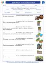
.◂Science Worksheets and Study Guides Seventh Grade. Weathering of rocks and soil formation
 Activity Lesson
 Worksheet/Answer key
 Worksheet/Answer key
 Worksheet/Answer key
 Worksheet/Answer key
 Vocabulary/Answer key
 Vocabulary/Answer key
 Vocabulary/Answer key
 Vocabulary/Answer key
