Geological Maps: Explanation and Study Guide
Geological maps are a type of map that provides information about the geological features and formations present in a specific area. These maps are essential tools for geologists, engineers, and other professionals involved in land use planning, mineral exploration, and environmental management.
Key Components of Geological Maps
Geological maps typically include the following key components:
- Rock types: Different rock types are represented using distinct colors or patterns on the map.
- Geological structures: Features such as faults, folds, and other structural elements are depicted to show the arrangement of rock layers.
- Topographic information: Contour lines and elevation data provide details about the terrain and surface features.
- Legend and symbols: A legend is included to explain the meaning of colors, patterns, and symbols used on the map.
- Scale and orientation: The scale of the map and its orientation (north arrow) are essential for accurate interpretation.
Interpreting Geological Maps
When interpreting geological maps, it's important to consider the following factors:
- Rock types: Identify and analyze the distribution of different rock types in the area.
- Geological history: Understand the sequence of geological events and the formation of various structures over time.
- Structural features: Examine the orientation of faults, folds, and other geological structures to infer the history of tectonic activities.
- Topography and drainage patterns: Consider how the geological features influence the landforms and water flow in the area.
- Geological hazards: Assess the potential risks associated with geological conditions, such as landslides, sinkholes, or seismic activity.
Study Guide
Here are some key topics to study when learning about geological maps:
- Understanding rock types and their characteristics
- Interpreting contour lines and topographic maps
- Recognizing geological symbols and their meanings
- Analyzing geological history and formation processes
- Identifying geological hazards and their implications
By mastering these concepts, you'll be better equipped to read and interpret geological maps effectively.
Now that you have a good understanding of geological maps, you can explore how these maps are used in various scientific and practical applications.
[Geological Maps] Related Worksheets and Study Guides:
.◂Science Worksheets and Study Guides Third Grade. Relationships among living things
 Activity Lesson
 Worksheet/Answer key
 Worksheet/Answer key
 Worksheet/Answer key
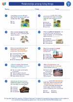
 Worksheet/Answer key
 Vocabulary/Answer key
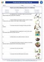
 Vocabulary/Answer key