Topography
Topography is the study of the shape and features of the surface of the Earth and other observable astronomical objects including planets, moons, and asteroids. It involves the measurement and representation of the elevations, slopes, and other physical features of the terrain.
Key Concepts
- Elevation: This refers to the height of a land surface above sea level. It is an important factor in determining the topography of an area.
- Contour lines: These are lines on a map that connect points of equal elevation. They help visualize the shape of the land and its features.
- Relief: This term refers to the differences in elevation within a specific area. It can be expressed as the range of elevation in an area or as the vertical difference between the highest and lowest points.
- Topographic maps: These maps represent the three-dimensional surface of the Earth in two dimensions, using contour lines and other symbols to depict the elevation and features of the land.
- Landforms: These are natural features of the Earth's surface, such as mountains, hills, valleys, and plains, which are a result of various geological processes.
Study Guide
When studying topography, it is important to understand the following key points:
- Learn to interpret contour lines on a topographic map and understand how they represent the shape and elevation of the land.
- Understand how elevation and relief contribute to the overall topography of a region.
- Identify and describe different types of landforms, including mountains, hills, valleys, and plains, and the processes that lead to their formation.
- Study the practical applications of topography, such as its role in land surveying, urban planning, and environmental management.
- Explore the use of modern technologies, such as Geographic Information Systems (GIS) and remote sensing, in topographic mapping and analysis.
Understanding topography is essential for various fields, including geography, geology, environmental science, and civil engineering. It provides valuable insights into the physical characteristics of the Earth's surface and plays a crucial role in natural resource management and land use planning.
By mastering the concepts and skills related to topography, you can develop a deeper appreciation for the diverse landscapes of our planet and gain the knowledge needed to engage in scientific inquiry and exploration.
.◂Science Worksheets and Study Guides Fifth Grade. Energy and ecosystems

 Worksheet/Answer key
 Worksheet/Answer key
 Worksheet/Answer key
 Vocabulary/Answer key
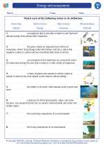
 Vocabulary/Answer key
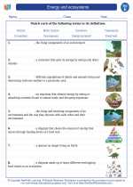
 Vocabulary/Answer key