Geographical Boundaries
Geographical boundaries are the lines or natural features that separate one area from another. These boundaries can be physical, such as rivers, mountains, and oceans, or they can be imaginary lines established by people, such as national borders or state lines.
Types of Geographical Boundaries
There are several types of geographical boundaries:
- Natural Boundaries: These boundaries are formed by physical features of the earth, such as rivers, mountains, and oceans. For example, the Mississippi River serves as a natural boundary between several states in the United States.
- Political Boundaries: These are boundaries that are created by humans to separate different countries, states, or territories. They are often established through treaties, agreements, or historical events.
- Cultural Boundaries: These boundaries are based on cultural differences, such as language, religion, or ethnicity. They can be seen in the divisions between regions that have different cultural traditions.
Importance of Geographical Boundaries
Geographical boundaries are important for several reasons:
- They help define the extent of a particular area, such as a country or state.
- They can influence the distribution of resources, such as water, minerals, and arable land.
- They can affect the movement of people, goods, and ideas between different regions.
- They can contribute to the formation of distinct political, cultural, and economic regions.
Study Guide
To study geographical boundaries, consider the following questions:
- What are the different types of geographical boundaries?
- How do natural boundaries differ from political boundaries?
- Give examples of geographical boundaries in your own country or region.
- Why are geographical boundaries important for understanding the world?
- How do geographical boundaries influence the interactions between different regions?
By understanding geographical boundaries, you can gain insights into the ways in which physical and human geography shape the world around us.
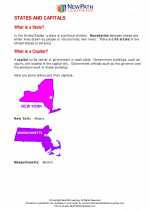
.◂Social Studies Worksheets and Study Guides Fifth Grade. States and Capitals
Study Guide States and Capitals
  Worksheet/Answer key
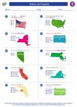
 States and Capitals
  Worksheet/Answer key
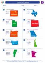
 States and Capitals
  Worksheet/Answer key
 States and Capitals

 Worksheet/Answer key
 Worksheet/Answer key
 Worksheet/Answer key

The resources above cover the following skills:
Geography: A student should be able to utilize, analyze, and explain information about the human and physical features of places and regions. A student who meets the content standard should:
Understand that a region is a distinct area defined by one or more cultural or physical features.