Geographical Boundaries
Geographical boundaries are natural or artificial lines that separate different regions and areas on the Earth's surface. These boundaries can be physical features such as rivers, mountains, and bodies of water, or they can be man-made, such as walls, fences, or lines of latitude and longitude. Geographical boundaries play a significant role in defining the extent and limits of countries, states, and other administrative units.
Types of Geographical Boundaries:
- Natural Boundaries: Natural boundaries are formed by physical features such as rivers, mountains, and oceans. These boundaries are determined by the natural landscape and are relatively permanent.
- Artificial Boundaries: Artificial boundaries are created by humans and may include walls, fences, or lines of latitude and longitude. These boundaries are established through agreements, treaties, or other legal means.
- Geometric Boundaries: Geometric boundaries are straight lines that are often used to create political boundaries, especially in areas with little topographical features. These boundaries can be found in places like the western United States and parts of Africa.
- Cultural Boundaries: Cultural boundaries are based on differences in ethnicity, language, religion, or other cultural factors. These boundaries may be less visible on the landscape but can have significant impacts on the way people interact with each other.
Importance of Geographical Boundaries:
- Geographical boundaries are crucial for defining the extent of a country or state and determining its territorial sovereignty.
- They help in managing and regulating the movement of people, goods, and resources across different regions.
- Geographical boundaries can also influence the cultural, social, and political identities of the people living within them.
Study Guide:
- What are geographical boundaries?
Geographical boundaries are natural or artificial lines that separate different regions and areas on the Earth's surface. - Name the types of geographical boundaries.
Natural boundaries, artificial boundaries, geometric boundaries, and cultural boundaries. - Explain the importance of geographical boundaries.
Geographical boundaries are crucial for defining the extent of a country or state and determining its territorial sovereignty. They help in managing and regulating the movement of people, goods, and resources across different regions and can influence cultural, social, and political identities.
[Geographical Boundaries] Related Worksheets and Study Guides:
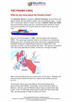
.◂Social Studies Worksheets and Study Guides Sixth Grade. Panama Canal
Study Guide Panama Canal
  Worksheet/Answer key
 Panama Canal
  Worksheet/Answer key
 Panama Canal
  Worksheet/Answer key
 Panama Canal

 Worksheet/Answer key
 Worksheet/Answer key
 Worksheet/Answer key

The resources above cover the following skills:
United States Studies: The Industrial Revolution to the Present
Identify cultural and economic developments in the United States from 1900 through the 1930s.
Identifying notable persons of the early 1900s.
Reading Standards for Literacy in History/Social Studies
Craft and Structure
Determine the meaning of words and phrases as they are used in a text, including vocabulary specific to domains related to history/social studies.
Describe how a text presents information (e.g., sequentially, comparatively, causally).
Range of Reading and Level of Text Complexity
By the end of Grade 8, read and comprehend history/social studies texts in the Grades 6-8 text complexity band independently and proficiently.